Patchogue (LIRR station)
|
Patchogue
|
|||||||||||
|---|---|---|---|---|---|---|---|---|---|---|---|
| File:Patchogue Station.jpg
Patchogue Station from the entrance at Division Street & Cedar Avenue; December 26, 2007
|
|||||||||||
| Location | Division Street & South Ocean Avenue Patchogue, New York |
||||||||||
| Coordinates | Lua error in package.lua at line 80: module 'strict' not found. | ||||||||||
| Owned by | Long Island Rail Road | ||||||||||
| Line(s) | Lua error in package.lua at line 80: module 'strict' not found. | ||||||||||
| Platforms | 1 side platform | ||||||||||
| Tracks | 2 | ||||||||||
| Connections | |||||||||||
| Construction | |||||||||||
| Parking | Yes ($2.00 for 12 hours) | ||||||||||
| Bicycle facilities | Yes | ||||||||||
| Disabled access | Yes | ||||||||||
| Other information | |||||||||||
| Fare zone | 10 | ||||||||||
| History | |||||||||||
| Opened | April 1869 (SSRRLI)[1] | ||||||||||
| Rebuilt | 1888, 1963, 1997 | ||||||||||
| Traffic | |||||||||||
| Passengers (2006) | 2,327[2] | ||||||||||
| Services | |||||||||||
|
|||||||||||
Patchogue is a station of the Montauk Branch of the Long Island Rail Road in the village of Patchogue, New York. It is on Division Street between West Avenue (Suffolk County Road 19) and South Ocean Avenue. This train station is located in the Patchogue-Medford Union Free School District.
Ferries to Fire Island board from a port near the station.[3]
History
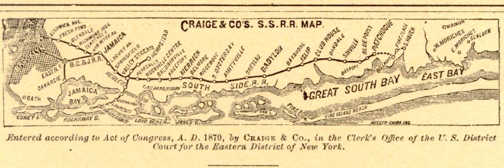
Between 1869 and 1879 Patchogue Station was the east end of the South Side Railroad of Long Island. It even had spurs and roundhouses between West and Railroad Avenues, as well as another spur between River Avenue and West Avenue for the textile plant that now serves as the Patchogue Campus of Briarcliffe College. Prior to acquisition by the Long Island Rail Road there was a proposal by the SSRRLI to extend the main line southeast towards Bellport, then northeast to Brookhaven and Southaven. The station in Brookhaven was to be named "Fireplace" after Fireplace Neck.[4] The station was rebuilt in 1889 and again on July 30, 1963.[5][6] As part of the 1963 reconstruction, Railroad Avenue was terminated at Sephton Street, along the north side of the tracks, and the baggage and express house was torn down for additional parking. When Blue Point Station was closed by the Long Island Rail Road in 1980, former Blue Point commuters opted to use Patchogue station. High-level platforms were added in 1997 for dual-deck trains.
PD Tower
Lua error in package.lua at line 80: module 'strict' not found.
In 1912, the Long Island Rail Road added a control tower to Patchogue Station on South Ocean Avenue, for both the Montauk Branch and the former trolley line owned by the Suffolk Traction Company. The tower was designated by the LIRR as the "PD Tower" and was also used for hooping. In 1970, all switches and crossing were automated, but hooping continued. At this point, the tower's structure began to decline. Residents began referring to it as the "Leaning Tower of Patchogue." On August 23, 2006 the tower was finally torn down.[7] Today, a flower garden can be found where the tower used to stand.
Platform and tracks
| ■ Montauk Branch | no stop (passing track) | |
| 1 | ■ Montauk Branch | toward New York (Sayville) |
| ■ Montauk Branch | toward Montauk (Bellport) |
The station has one six-car-long high-level platform on the south side of the two tracks; the north track, not next to the platform, is a siding.
Connections
- Suffolk County Transit buses S40, S54, S61, S63, S66, S68, 7A, and 7B.
- Patchogue's local jitney bus routes
- Passenger Ferries to Davis Park and Watch Hill on Fire Island.
References
- ↑ Vincent F. Seyfried, The Long Island Rail Road: A Comprehensive History, Part One: South Side R.R. of L.I., © 1961
- ↑ Average weekday, 2006 LIRR Origin and Destination Study
- ↑ Lua error in package.lua at line 80: module 'strict' not found.
- ↑ Craige & Company's 1870 Southside Railroad of Long Island Map (Arrt's Arrchive)
- ↑ LIRR Station History (Dave Keller's Long Island Rail Road Photos & Recollections)
- ↑ Lua error in package.lua at line 80: module 'strict' not found.
- ↑ Lua error in package.lua at line 80: module 'strict' not found.
External links
| Wikimedia Commons has media related to Patchogue (LIRR station). |
- Official LIRR station information page for Patchogue
- Station timetable for Patchogue
- PD Tower (Unofficial LIRR History Website)
- Older Patchogue Station(Newsday)
- Original Patchogue Station (Arrt's Arrchives)
- Patchogue Village Bus
- Railfan Recollections at LIRR “PD” Tower and signals (TrainsAreFun.com)
- More PD Tower Pics (May 1, 2006)
- Unofficial LIRR Photography Site (lirrpics.com)
- PD Interlocking and The Leaning Tower of Patchogue (The LIRR Today) (registration required)
- Station from Ocean Avenue from Google Maps Street View
- Pages with broken file links
- Articles using small message boxes
- Commons category link is defined as the pagename
- Pages with login required references or sources
- Long Island Rail Road stations
- Railway stations in Suffolk County, New York
- Railway stations opened in 1869
- Patchogue, New York
- 1869 establishments in New York