Colsterworth
| Colsterworth | |
| 240px A drawing of Colsterworth Church, by the antiquarian William Stukeley |
|
| 240px The crossroads in the centre of the village |
|

Colsterworth
|
|
| OS grid reference | SK932240 |
|---|---|
| – London | 90 mi (140 km) S |
| Civil parish | Colsterworth |
| District | South Kesteven |
| Shire county | Lincolnshire |
| Region | East Midlands |
| Country | England |
| Sovereign state | United Kingdom |
| Post town | GRANTHAM |
| Postcode district | NG33 |
| Police | Lincolnshire |
| Fire | Lincolnshire |
| Ambulance | East Midlands |
| EU Parliament | East Midlands |
|
|
.png)
Lua error in package.lua at line 80: module 'strict' not found.
Colsterworth is a village and civil parish in the South Kesteven district of Lincolnshire, England. It is situated less than half a mile (0.8 km) west from the A1, and approximately 7 miles (11 km) south from Grantham and 12 miles (19 km) north-west from Stamford.
The village, together with the hamlet of Woolsthorpe-by-Colsterworth, had a population of 1508 according to the 2001 Census.
Contents
History and architecture
The name Colsterworth is from the Old English 'colestre' + 'worth' for "enclosure of the charcoal burners"; the name appears as "Colsteuorde" in the Domesday Book.
The village dates from the Roman era. It is close to Ermine Street, the old Roman road that ran from London directly north to Lincoln and to the Roman road known as High Dyke. A Roman smelting furnace was found at Colsterworth in 1931, as was a small defended Late Iron Age settlement in the 1940s.[1]
Colsterworth is raised upon a slight limestone ridge, with the River Witham running below on the western side and bisecting the two villages. The old hamlet of Twyford has been incorporated by the growth of Colsterworth, but the name survives in the names of some houses and in Twyford Wood. The area between Colsterworth Church and Twyford was once known as Dunkirk. Colsterworth, Woolsthorpe and Twyford are all separately entered in the Domesday Book of 1086.[2] The village belonged to the historical wapentake of Winnibriggs and Threo.[3]
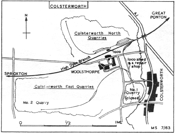
The enclosures of the land in 1808 allowed the local landlords to increase their holdings. Thirty villagers also received land, but some sold on to avoid the compulsory expense of fencing it. Colsterworth...The rector commuted his tythes for 398 acres, in addition to his 11 acres of glebe. The position of Colsterworth on the Great York Road, later the Great North Road, became important as soon as the turnpike road was completed in 1752. It was appointed a post town, and by the mid-19th century had a thriving coaching trade. There were numerous inns - ten at one time. However, the village was bypassed in 1935.[4] The old coaching inns have been transformed into houses or business properties, such as The George House and The Sun Pottery, or demolished completely. The White Lion public house, standing opposite the parish church of St John the Baptist, alone now serves the population. About that time, ironstone workings began. These were closed in the 1970s and the site rehabilitated.[5] Colsterworth also lies one mile to the west of Twyford Wood, which was the site of a Second World War airfield RAF North Witham, and still retains military artefacts, including open runways and a derelict control tower. After the war, the grassed part of the airfield was planted with oaks and conifers. The grassland habitat is home to a regionally important colony of dingy and grizzled skipper butterflies.[6]
In 1884 the Rev'd J. Mirehouse, rector of Colsterworth, was responsible for the Home Office Baby publicity stunt.[citation needed]
The origins of the parish church of St John the Baptist go back to Saxon times, as indicated by the herring-bone stonework in the chancel. The Norman arches were preserved during Victorian renovation, of which this church is a prime example. The surrounding churchyard has been closed for almost a century but is kept in order by the Parish Council. Inside the church, behind the organ, is a stone sundial plate that was cut with a penknife by Sir Isaac Newton when nine years of age. The stone, which has no gnomon, is mounted upside down below a carved wooden effigy of the scientist.[1] Newton's mother, Hannah Ayscough (died 1642) and father, also called Isaac (died 1673), were buried in the church.[7]
Colsterworth belongs to the Colsterworth Group of Anglican churches, sharing a priest with Holy Cross, Great Ponton, St Guthlac, Little Ponton, St James, Skillington and St Andrew and St Mary at North and South Stoke Rochford with Easton. It is in the deanery of Beltisloe.
Methodism came to Colsterworth about 1795. The present Methodist church in Back Lane dates back to the 1830s.[5]
Although the oldest dwellings are of limestone, 1920s and 1930s brick homes are interposed amongst them. During the 1970s a large estate, Woodlands Drive, was built on ground previously belonging to Colsterworth House,[8] which was demolished. The land between the village and the A1 was developed into a new housing estate. More recently, in 2009, a further housing development commenced on land previously utilised for steel storage and distribution, known as Newton Grange.[citation needed]
Economy and amenities
There is little employment in the village itself. During, and for some time after, the Second World War work was available at the ironstone excavations,[9] but after operations ceased the site was filled and levelled. A tyre depot and Christian Salvesen food cold-store offer local employment. Farming, the traditional occupation that previously absorbed most of the available workforce, still provides some employment, for instance at the Openfield grain cooperative on the former RAF station. There is work at fast-food restaurants Little Chef, OK Diner and Travelodge on the A1, and at the nearby Stoke Rochford Hall, a conference and function centre.[citation needed]
The village has a post office, surgery, Co-op store and hairdresser, with greengrocer, butcher and fishmonger mobile shops. There is a mobile library service.[10] The village is policed by a touring police constable.[citation needed]
Colsterworth's Church of England primary school also provides for children in neighbouring villages. It has about 100 pupils in five classes that span the seven years of primary education.[11] The school is a "guardian school" for nearby Woolsthorpe Manor,[12] the birthplace of Sir Isaac Newton.[13] The new school buildings that opened in Back Lane in 1973 replaced earlier ones in School Lane, dating from 1824 and 1895.[5]
The A1 trunk road at Colsterworth was redeveloped in 2010 with the removal of Colsterworth roundabout and an added road bridge over the A1 for local traffic, this to address safety and traffic congestion concerns.[14] The village is on the bus route between Grantham and Witham.[15]
The former Lincoln City footballer Ayden Duffy was brought up in Colsterworth.[citation needed]
Village archive group
A village archive group was founded to record memories of Colsterworth people for posterity. The group's aim is to chronicle local social history and changes in dialect, and publish material as a resource and educational tool in book and DVD form. It has been funded by Lincolnshire Community Champions and the Local Heritage Initiative, now under the auspices of the Heritage Lottery Funding.[2]
Civil parish
The civil parish includes the village of Woolsthorpe-by-Colsterworth, 0.6 miles (1 km) north west of Colsterworth. The parish shares a grouped parish council with Gunby and Stainby and North Witham, known as Colsterworth and District Parish Council.[16]
Woolsthorpe-by-Colsterworth
<templatestyles src="Module:Hatnote/styles.css"></templatestyles>
Woolsthorpe-by-Colsterworth is notable as the birthplace of Sir Isaac Newton, his home, Woolsthorpe Manor, being a visitor attraction. Woolsthorpe-by-Colsterworth village hall was built as a result of an appeal in Newton's memory, and is named after him. Newton was christened in Colsterworth Church, where a copy of the entry in the register is to be found.[7]
References
- ↑ 1.0 1.1 "Colsterworth and District Parish Council", Lincolnshire.gov.uk. Retrieved 30 April 2012
- ↑ 2.0 2.1 "Welcome to the Village Archive Group web site!", Villagearchivegroup.com. Retrieved 30 April 2012
- ↑ "Winnibriggs and Threo Wap", A Vision of Britain through Time, Retrieved 16 March 2012
- ↑ "Villages Three - A short history of the Parish of St John the Baptist, Colsterworth", Lincolnshire.gov.uk. Retrieved 30 April 2012
- ↑ 5.0 5.1 5.2 "History of Colsterworth", Villagearchivegroup.com. Retrieved 30 April 2012
- ↑ "Explore Twyford Wood", Forestry.gov.uk. Retrieved 30 April 2012
- ↑ 7.0 7.1 "The Church of Saint John the Baptist,Colsterworth". Retrieved 30 April 2012
- ↑ "Colsterworth House", Lincolnshire.gov.uk. Retrieved 30 April 2012
- ↑ "Colsterworth", Industrial Railway Society.
- ↑ "Welcome to the Mobile Library Service", Lincolnshire.gov.uk. Retrieved 30 April 2012.]
- ↑ "About The School", Colsterworth.lincs.sch.uk. Retrieved 30 April 2012.]
- ↑ "Our Community", Colsterworth.lincs.sch.uk. Retrieved 30 April 2012
- ↑ "Woolsthorpe Manor - Join in", Nationaltrust.org.uk. Retrieved 30 April 2012
- ↑ "A1 Peterborough to Blyth Junction Improvements", Highways Agency. Retrieved 18 July 2011
- ↑ "Grantham - South Witham", Lincolnshire.gov.uk. Retrieved 30 April 2012
- ↑ Lua error in package.lua at line 80: module 'strict' not found.
External links
 Media related to Lua error in package.lua at line 80: module 'strict' not found. at Wikimedia Commons
- "Woolsthorpe Manor", National Trust
- "Isaac Newton", Newsreel, British Pathe
- Colsterworth and District Parish Council
| Unitary authorities | |
|---|---|
| Boroughs or districts | |
| Major settlements |
|
| Topics | |